
Where to see wildlife in Tisbury and surrounding areas?
Photo and text by Andrew Graham.
The Tisbury area benefits from a diverse landscape based on a combination of its varying geology and its management by man over the centuries. Its importance for wildlife is reflected in the number of locations with environmental designations.
The clay vale of the Nadder river valley is a particular feature which threads its way eastwards from the Donheads towards its confluence with the Avon in Salisbury. Seasonal flooding creates some area of flood meadow and marsh. Along the Nadder’s length, it is joined by a number of smaller tributaries running down off the higher chalk ridges to the north and south. These form valleys such as those of the Fonthill and Oddford Brooks as well as at Fovant, Teffont and Chilmark. All are broadly at right angles to the Nadder valley.
Scattered through the area are the remains of historic parks and numerous remnants of ancient woodland. The scarp slope of the Shaston ridge running in a SW/NE direction to the south of the A30 provides large areas of chalk grassland rich in wildflowers as do the unimproved downs and coombes on dip slopes of the Chalke Valley beyond.
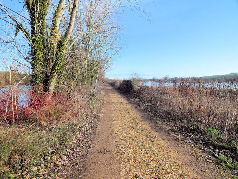
Not all these habitats are easily accessible however, although a combination of the rights of way network and open access land will allow you to see plenty of wildlife.
The clay vale of the Nadder river valley is a particular feature which threads its way eastwards from the Donheads towards its confluence with the Avon in Salisbury. Seasonal flooding creates some area of flood meadow and marsh. Along the Nadder’s length, it is joined by a number of smaller tributaries running down off the higher chalk ridges to the north and south. These form valleys such as those of the Fonthill and Oddford Brooks as well as at Fovant, Teffont and Chilmark. All are broadly at right angles to the Nadder valley.
Scattered through the area are the remains of historic parks and numerous remnants of ancient woodland. The scarp slope of the Shaston ridge running in a SW/NE direction to the south of the A30 provides large areas of chalk grassland rich in wildflowers as do the unimproved downs and coombes on dip slopes of the Chalke Valley beyond.
Not all these habitats are easily accessible however, although a combination of the rights of way network and open access land will allow you to see plenty of wildlife.
General advice on access to the countryside when looking for wildlife
Rights of way
Our local Rights of Way network is well used, relatively well maintained and waymarked and we are fortunate that it is relatively comprehensive. All rights of way are marked on Ordnance Survey maps and only very rarely change so you can be confident in using routes that are mapped. Any diversions should be very clearly waymarked and explained.
All rights of way can be traversed on foot, but bridleways, restricted byways and byways open to all traffic can be used on bicycles – if you want to get further quicker.
If you want to see wildlife, it is best to leave dogs at home. If you do take them, the Countryside Code advises that dogs should always be kept under effective control, in sight, and should not be allowed to stray off the path. You should of course, pick up after your dog in all circumstances.
Some landowners allow permissive access along paths that are not rights of way. Obviously staying to the path and not causing any problems when using the path is doubly important in these circumstances or the permissive access may be lost to everyone.
Open Access countryside
Under the Countryside and Rights of Way Act 2000 (CROW Act) members of the public have access to “open country” and registered common land. These areas are marked on recent (i.e., published after 2000) OS sheets using a buff-coloured tone with darker buff edges.
Access is only permissible on foot. Visitors using their open access rights must keep dogs on a short lead of no more than 2 metres between 1 March and 31 July each year and at all times near livestock. Beyond these constraints, and subject to stock fencing or hedges etc. you are free to explore and enjoy this open country and investigate its wildlife.
In this area we benefit from scattered small areas of common land as well as extensive areas of downland along either side of the Shaston Ridge and the sides of the Chalke Valley. As visitors are not channelled along paths (as they are on rights of way) human pressure and disturbance is therefore much reduced and the chances of encountering wildlife correspondingly increased.
So, where can I see wildlife in the area?
These are some of the best places, locally, to visit with the aim of seeing wildlife. See further down details on each of the locations and how to access them.
|
Woodlands
Grasslands
|
Water
Miscellaneous
|
Woodlands
|
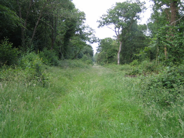
Photo: Andy Gryce / Wood, Great Ridge near Chicklade
geograph.org.uk via Wiki Commons |
Photo: Andrew Smith / Mackintosh Davidson Wood, West Knoyle
geograph.org.uk via Wiki Commons |
Wardour Woods
Park at the Old Castle. (ST 938264; WTW ///research.observers.reason)
A number of tracks around the woods allow you to explore them and to get views of the lakes within them. Good for all kinds of woodland birds as well as breeding and overwintering wildfowl. Although planted up with non-native coniferous species, parts of these woods are ancient, and the longstanding woodland cover means the floor is rich with fungi in autumn.
Great Ridge Wood
This large, ancient wood is a bit awkward to get to as it is somewhat remote but can be accessed by public footpaths leading in from north and south. There is a good network of rights of way through the woods mostly along good forest tracks. The woodland is managed for forestry and shooting, is very diverse with a mix of old hazel coppices, coniferous plantations, and open valleys with scattered trees. The varied landform means there are always some sheltered areas despite the hilltop location. It is possible to spend hours here and not see a soul.
Grovely Wood
Parking possible at the end of a number of tracks leading toward the wood from the surrounding countryside but there is no formal car park.
Another ancient wood into which commercial forestry plantations have been inserted, but in contrast to Great Ridge Wood, most of the wood is designated as open access to the whole of the network of forest tracks and rides can be explored. The roughly W/E Broad Drive (the course of an old Roman road) is sheltered, catches the sun, and has a number of scallops cut out of the flanking vegetation providing variety and habitat for butterflies. It is one of the best places locally to see butterflies and is also good for birds. Small areas of downland on the southern edges are particularly worth seeking out.
Oysters Coppice and nearby
There is a small area where a few cars can park near the south-eastern corner of the wood in Gutch Common (ST 986258; WTW ///shields.redeemed.banquets).
A small ancient woodland on a damp north facing slope, owned by the Wiltshire Wildlife Trust (WWT). Committee members of the Tisbury and District Natural History Society have led volunteer groups undertaking management in the wood for many years, improving paths and reintroducing coppicing. Notable for wild daffodils and bluebells in spring, the wood also has a pond and marsh where amphibians breed.
Nearby, is Ambrose Copse owned and managed by the Woodland Trust and other woods along the scarp to the west recently acquired by WWT. Just to the east of Gutch Common there is an unusual area of bracken dominated open access land which blends into unmanaged woodland.
Puckwell Coppice/Mackintosh Davidson Wood
Park at the small pull-in in West Knoyle (ST 855320; WTW ///tenure.comically.downsize)
A mixture of woodland and grassland with sheltered rides of a variety of aspects. Good paths allow a thorough exploration.
Chase Woods (Rushmoor Estate)
Park at Cuttice Lodge at north entrance to the Estate (ST 957195; WTW /// blinks.slamming.diverged) or at the Golf Club where the clubhouse café/bar holds various attractions (ST 958189; WTW ///paddocks.gobbling.replayed)
Further afield, and spanning the border of Wiltshire and Dorset, these ancient woods are extensive, largely managed for timber production and have a couple of large sunlit south facing valleys. There is a good rights of way network, in addition to which permissive paths are marked on the ground, although other areas are out of bounds.
Garston Wood (RSPB)
Park at small car park (SU 003195; WTW ///grapevine.bank.loves)
A small ancient coppice with standards woodland managed for birds but which benefits other wildlife such as flowers and butterflies such as Purple Emperors.
Grasslands

|
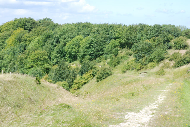
Photo: Dry valley by Knapp Down above Broad Chalke by Colin Park via Wikimedia Commons
|
Photo: Toby / The Ox Drove descends
geograph.org.uk via Wikimedia Commons |
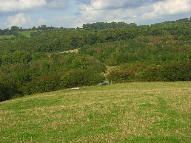
Downland along either side of Shaston Ridge/Chalke Valley
Park at one of the locations where roads cross the Shaftesbury Drove running along the ridge for example ST 965259; WTW ///beast.footpath.unionists SU 003268; WTW ///steepest.speeded.childcare or walk up along footpaths from the A30 or the Chalke Valley.
There are considerable swathes of unimproved downland pasture along either side of the Shaston Ridge and the Chalke Valley much of which is Open Access countryside, so we are free to visit. The caveat is that some of the areas are difficult to get to and are often crossed by fences which do not always have gates or stiles where you might want them. As well as far-reaching views, here you will find chalk loving plants and insects including Adonis Blue, Duke of Burgundy, as well as Grizzled and Dingy Skipper butterflies amongst others. Hares are a frequent sight.
Oddford brook Valley
Accessible directly from Tisbury village from Tuckingmill or the Nadder Centre, this is an interesting semi-wild valley with a footpath running its length up towards Fonthill Abbey Woods. A circular walk is possible by returning along the parallel bridleway to the NE through Weaveland Farm.
Water
|
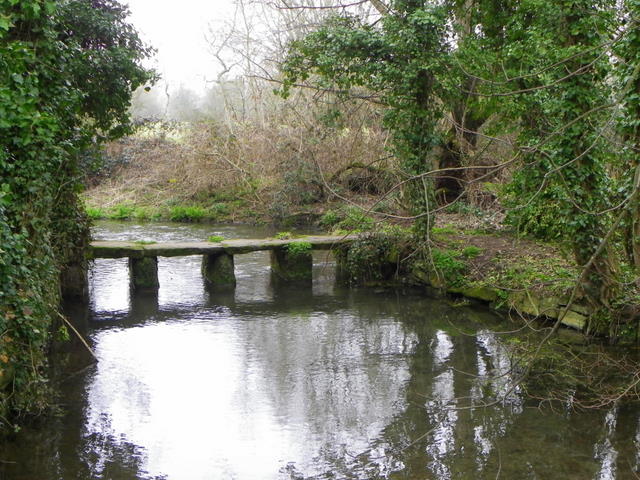
Photo: Clapper bridge, Bishopstone by Maigheach-gheal
geograph.org.uk via Wiki Commons |
Photo: Between the lakes, Steeple Langford by Jonathan Kington
geograph.org.uk via Wiki Commons |
.
Fonthill Lake
Accessible by footpath from the top of Hindon Lane in Tisbury village. One can also park at the pull in beside the road (ST 933317; WTW ///tanks.buddy.dries).
Wardour Castle pond and other nearby lakes
See under Woodland
River Nadder
In common with most rivers in England, the River Nadder is rarely accessible to the public. Rights of way cross it at a small number of locations between the Donheads and Salisbury but for the most part we are restricted to views of it from road bridges. The only place to get a good look is in the vicinity of Stubbles below St John’s church in Tisbury.
River Ebble
The Ebble is a smaller tributary of the Avon but is similarly inaccessible. However, it is possible to follow rights of way along the valley between Broad Chalke and Coombe Bisset to at least experience the river valley environment. There is a small permissive nature reserve alongside the Ebble at Mill Mead opposite the church car park in Broad Chalke (SU 041254: WTW ///pint.waddled.stealthier)
Langford Lakes
http://www.wiltshirewildlife.org/langford-lakes Car park SU 038369 WTW ///statue.handover.means
Although outside the immediate Tisbury area, this nature reserve well deserves a mention. A number of flooded gravel pits provide a location to see a great variety of resident and migratory birds which differ with the seasons. A number of hides allow sheltered viewing of the water in one case overlooking an artificial scrape which attracts large numbers of wildfowl and waders. In summer it is a good site for dragonflies and other insects. There is also a lakeside café (check website for opening which varies with season) from which customers may be rewarded with a view of an otter.
Miscellaneous
Drove roads
Another way to get out into open countryside far from habitation and therefore more likely to encounter undisturbed wildlife, is to walk along one of the hilltop drove roads. They can be good places to see migrant birds as well as a number of raptor species. These long-established routes are now rough tracks with rights of way all the way along them. In places they are flanked by scrub or woodland, elsewhere offering they offer fine views over large areas. It is easy to plan circular routes which take you off the ridge, into an adjacent valley and then back up again.
The Shaftesbury Drove, which runs along the Shaston Ridge was mentioned above under Grasslands. It runs from the A30 near Donhead St Andrew running about 22km east all the way to Harnham on the outskirts of Salisbury.
In addition, there are two other drove roads both, rather confusingly, called the Ox Drove.
The most northerly runs from near the A303 at Chicklade Bottom 7km eastwards until it enters Grovely Wood. Part of it is an easily walkable concrete road which dates to WWII. The easiest of several parking places from which to access the drove is at ST 982346 WTW ///tour.stalemate.supreme.
The southerly runs from Win Green above Berwick St John about 20km eastwards to the A354 south of Bishopstone. Park at Win Green (ST 923 205 WTE ///cope.backward.afraid) or one of the several locations elsewhere along its length where the drove crosses a metalled road.